Property Record
1030 Dahlonega Hwy, Cumming, GA 30040


NEARBY LISTINGS FOR SALE OR LEASE
Property Detail
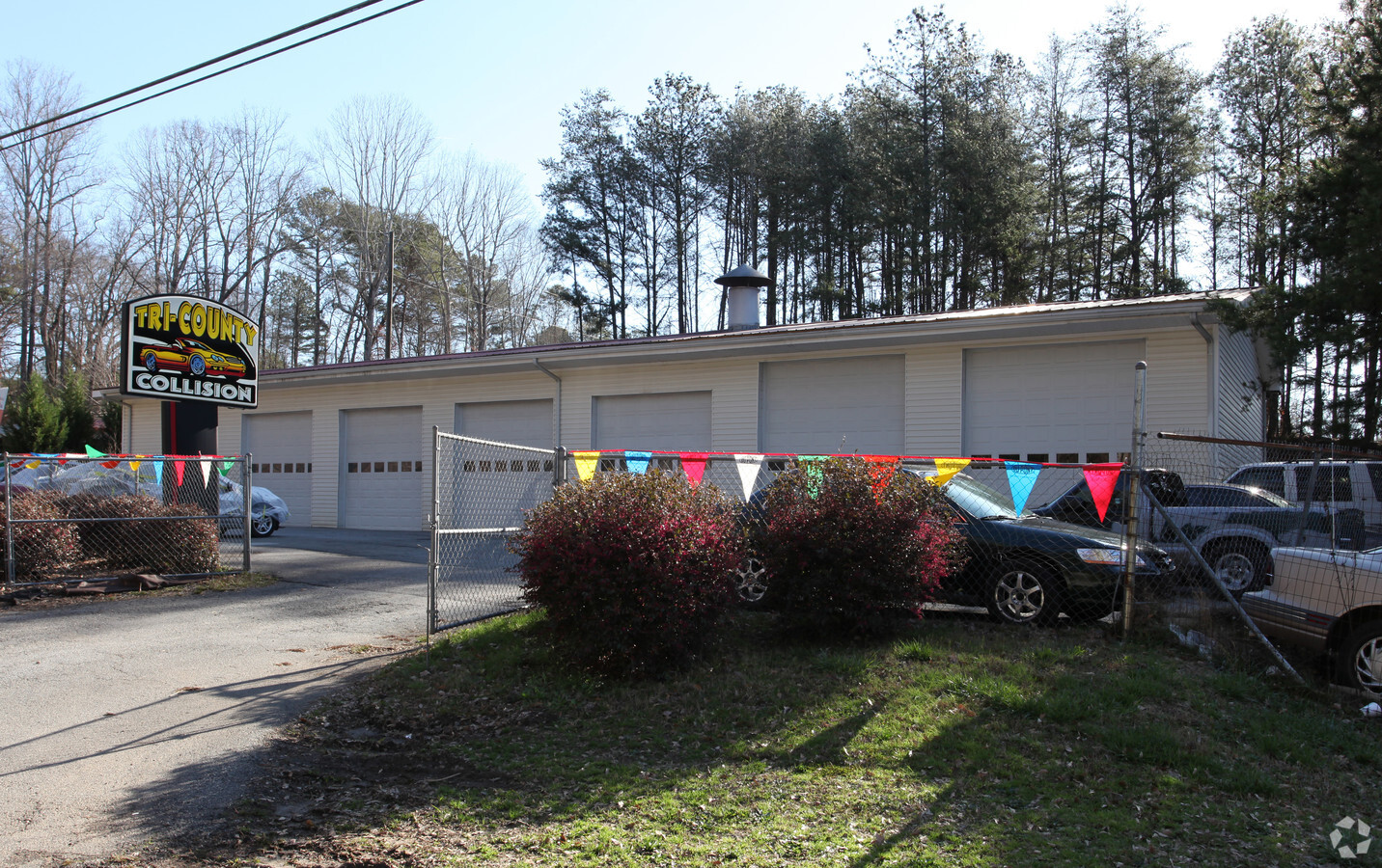
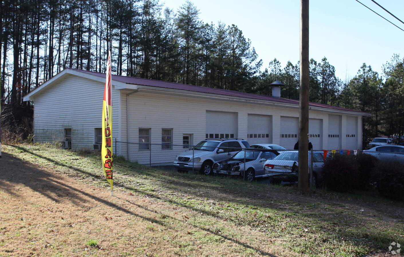
1030 Dahlonega Hwy
Atlanta-Sandy Springs-Roswell, GA
Tri-County Collision Center
C32-004
3-1 1050 TR 2
Publicstorage
Forsyth
X
Georgia
13139C0275G
2
2023
4.49 AC
2024
Cumming/Forsyth Cnty
130409
Atlanta
46,693 SF
DEMOGRAPHICS near 1030 Dahlonega Hwy
1 Mile
3 Mile
5 Mile
2024 Total Population
3,680
30,703
87,820
2029 Population
4,267
35,885
102,605
Pop Growth 2024-2029
+ 15.95%
+ 16.88%
+ 16.84%
Average Age
42
40
40
2024 Total Households
1,390
11,138
30,607
HH Growth 2024-2029
+ 15.97%
+ 17.01%
+ 16.90%
Median Household Inc
$80,514
$89,634
$104,248
Avg Household Size
2.60
2.70
2.80
2024 Avg HH Vehicles
2.00
2.00
2.00
Median Home Value
$266,121
$350,717
$392,876
Median Year Built
1996
1998
2002
Nearby Places
- Restaurants
- Banks
- Shops
- Fitness
- Groceries
Nearby Properties
Address
Land Use
TOTAL SIZE
Lot Size
Zoning
Address
Land Use
TOTAL SIZE
Lot Size
Zoning
10.82 AC
PUD
Address
Land Use
TOTAL SIZE
Lot Size
Zoning
312,095 SF
28.86 AC
PSC
Address
Land Use
TOTAL SIZE
Lot Size
Zoning
208,496 SF
23.61 AC
R3
Address
Land Use
TOTAL SIZE
Lot Size
Zoning
305,332 SF
23.75 AC
CBD
Address
Land Use
TOTAL SIZE
Lot Size
Zoning
95,926 SF
34.26 AC
HB
Address
Land Use
TOTAL SIZE
Lot Size
Zoning
62,085 SF
28.70 AC
INST
Address
Land Use
TOTAL SIZE
Lot Size
Zoning
24.78 AC
INST
Address
Land Use
TOTAL SIZE
Lot Size
Zoning
152,562 SF
12.80 AC
R3
Address
Land Use
TOTAL SIZE
Lot Size
Zoning
159,291 SF
29.19 AC
MU
Address
Land Use
TOTAL SIZE
Lot Size
Zoning
268,761 SF
55.50 AC
INST
Address
Land Use
TOTAL SIZE
Lot Size
Zoning
98,743 SF
12.61 AC
CBD
Address
Land Use
TOTAL SIZE
Lot Size
Zoning
267,180 SF
31.01 AC
INST
Address
Land Use
TOTAL SIZE
Lot Size
Zoning
175,237 SF
2.13 AC
CBD
Address
Land Use
TOTAL SIZE
Lot Size
Zoning
68,188 SF
121.31 AC
A1
Address
Land Use
TOTAL SIZE
Lot Size
Zoning
155,804 SF
3.24 AC
CBD
Address
Land Use
TOTAL SIZE
Lot Size
Zoning
17,657 SF
59.25 AC
A1
Address
Land Use
TOTAL SIZE
Lot Size
Zoning
151,580 SF
21.78 AC
MU
Address
Land Use
TOTAL SIZE
Lot Size
Zoning
114,998 SF
13.09 AC
INST
Address
Land Use
TOTAL SIZE
Lot Size
Zoning
2,750 SF
276.79 AC
A1
Address
Land Use
TOTAL SIZE
Lot Size
Zoning
588 SF
110 AC
INST
Address
Land Use
TOTAL SIZE
Lot Size
Zoning
75,480 SF
14.56 AC
M1
Address
Land Use
TOTAL SIZE
Lot Size
Zoning
1,752 SF
170.87 AC
A1
Address
Land Use
TOTAL SIZE
Lot Size
Zoning
53,870 SF
5.61 AC
PSC
Address
Land Use
TOTAL SIZE
Lot Size
Zoning
198,331 SF
14.47 AC
M1
Address
Land Use
TOTAL SIZE
Lot Size
Zoning
123,783 SF
22.07 AC
A1
Address
Land Use
TOTAL SIZE
Lot Size
Zoning
33,774 SF
4.79 AC
R3
Address
Land Use
TOTAL SIZE
Lot Size
Zoning
115,804 SF
12.79 AC
PSC
Address
Land Use
TOTAL SIZE
Lot Size
Zoning
36,257 SF
5.63 AC
CBD
Address
Land Use
TOTAL SIZE
Lot Size
Zoning
113,537 SF
11.94 AC
INST
Address
Land Use
TOTAL SIZE
Lot Size
Zoning
42,564 SF
10.69 AC
INST
The World's #1 Commercial Real Estate Marketplace
Connect with us
© 2025 CoStar Group
The information above has been obtained from sources believed reliable. While we do not doubt its accuracy we have not verified it and make no guarantee, warranty or representation about it. It is your responsibility to independently confirm its accuracy and completeness. Any projections, opinions, assumptions, or estimates used are for example only and do not represent the current or future performance of the property. The value of this transaction to you depends on tax and other factors which should be evaluated by your tax, financial, and legal advisors. You and your advisors should conduct a careful, independent investigation of the property to determine to your satisfaction the suitability of the property for your needs.